
Severe Storms Possible Friday Evening Followed by a Cold Weekend
A significant cold front will advance through the tri-state area on Friday evening, leading to a series of strong to severe storms.
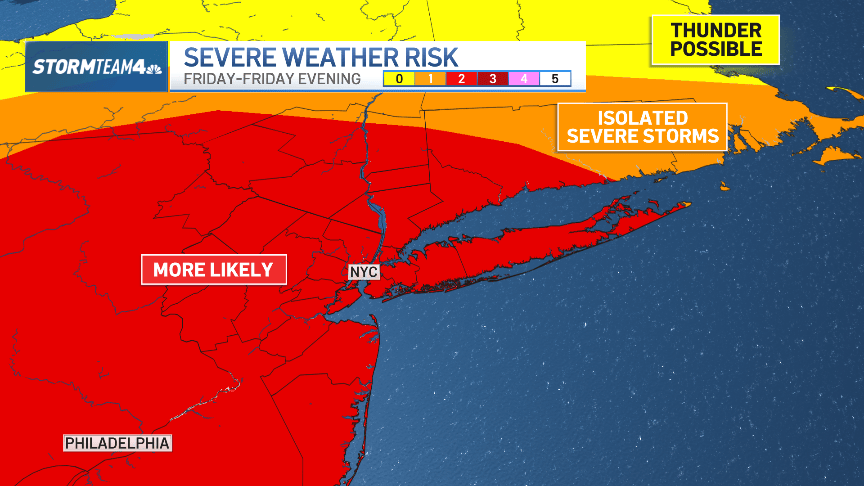
A significant cold front will advance through the tri-state area on Friday evening, leading to a series of strong to severe storms. The day will start with light to moderate showers, resulting in a wet commute, but the rain is expected to taper off by the afternoon. Temperatures will rise into the mid 70s, accompanied by increased humidity, setting the stage for the evening storms.
These storms are anticipated to form a squall line, characterized by fast-moving and intense weather, with the primary concern being destructively strong wind gusts, particularly west of New York City. There is also a risk of isolated tornadoes from the Delaware Water Gap extending into Pennsylvania.
Storms are expected to reach the Catskills and Poconos between 5 p.m. and 6 p.m. before arriving in the NYC area around 8 p.m. Residents should prepare for gusty winds, lightning, and heavy rainfall, although these conditions will likely last only 20 to 30 minutes in any given location. As the storms move eastward and encounter more stable air, they will weaken, but strong wind gusts will still impact the metropolitan area.
Following the storms, cooler temperatures will prevail throughout the weekend, with highs around the low 50s on Saturday and gusty winds adding to the chill. Sunday will bring calmer and sunnier conditions, though temperatures will remain unseasonably cool, with morning lows near the upper 30s and afternoon highs only in the mid 50s. Next week, temperatures are expected to rise to the low and mid-60s with dry conditions predicted.


Comments
No comments yet.